
Population and migration are foundational concepts in human geography, helping us understand how people are distributed across the globe and why they move from place to place.
Understanding Population and Migration
Population refers to the total number of people living in a defined geographic area. This can be on the scale of a city, country, or the entire world. Migration is the movement of people from one location to another, either permanently or temporarily. Migration can be internal (within a country) or international (across national borders), and may occur for a wide variety of reasons.
Human geographers study population and migration to analyze spatial patterns and determine the causes and consequences of population change. These insights help explain where people are concentrated, how societies grow and change, and the implications for economies, environments, and cultural landscapes. Population growth, density, and migration patterns influence urban planning, public services, environmental sustainability, and political power.
Why People Live Where They Do
Where people choose to live is not random—it is shaped by a combination of physical and human factors that make certain places more favorable for settlement than others.
Physical Factors
Physical geography greatly influences population distribution, particularly in relation to environmental comfort and resource availability. The most densely populated regions of the world tend to share key environmental features:
Climate: Moderate climates that are neither too hot nor too cold attract larger populations. These include temperate zones with distinct seasons and predictable weather patterns. Harsh environments such as polar zones, deserts, and tropical rainforests often discourage settlement due to temperature extremes, limited resources, or disease prevalence.
Landforms and Elevation: Flat or gently rolling terrain is easier to build on, cultivate, and access. Lowland areas are typically more densely populated than mountainous regions, which pose difficulties for construction, transportation, and agriculture. For example, the Andes Mountains in South America are sparsely populated compared to the nearby lowlands.
Soil Fertility: Fertile soils support agriculture and enable large populations to be sustained over time. Regions like the Ganges River valley or the Nile Delta have supported dense human settlements for millennia due to their rich soils.
Water Sources: Access to freshwater is vital for survival, sanitation, and agriculture. Rivers, lakes, and underground aquifers are essential for supporting populations. Major civilizations historically developed near water bodies, such as the Nile in Egypt, the Tigris and Euphrates in Mesopotamia, and the Yangtze in China.
Natural Resources: The availability of fuel, minerals, and timber can attract settlements that grow into industrial or commercial hubs. The presence of oil, coal, or fertile land can transform a remote area into a booming center of population and development.
Human Factors
Human decisions and social structures play an equally significant role in determining population distribution. While physical factors may make a place livable, human factors often determine where people actually settle.
Economic Opportunities: People are drawn to places where they can find employment and build a better quality of life. Industrial zones, business districts, and urban centers often attract internal and international migrants.
Cultural and Social Networks: People often move to be near family members or communities of similar cultural, ethnic, or religious backgrounds. Social networks help new migrants settle in unfamiliar places and can reinforce population clusters over time.
Political Stability and Safety: Areas with stable governments and low crime rates tend to attract people, while those affected by war, corruption, or persecution experience emigration. Refugees often flee from conflict zones to safer countries.
Public Services and Infrastructure: Access to quality education, healthcare, transportation, and utilities makes regions more desirable. Developed countries and cities with strong infrastructure tend to attract both domestic and international migrants.
Government Policies: Government actions, such as offering housing subsidies, building new cities, or restricting movement, can encourage or discourage population growth in certain areas.
Patterns of Population Distribution
The Earth’s population is not spread evenly. Population distribution refers to the way people are spread across a region or the world. Most people live in clusters in regions with favorable conditions. Globally, population concentrations are found in:
East Asia – particularly eastern China, Japan, and South Korea
South Asia – especially India, Pakistan, and Bangladesh
Southeast Asia – including Indonesia, Vietnam, and the Philippines
Europe – with high densities in the UK, Germany, and the Netherlands
Eastern North America – particularly along the northeastern corridor of the United States
In contrast, regions such as the Sahara Desert, Arctic tundra, and central Australia have very low population densities due to extreme physical environments.
Types of Population Density
Population density is a key measure used by demographers to understand how crowded or dispersed a population is within a specific area. There are three commonly used types of density:
Arithmetic Population Density
Definition: Total population divided by total land area.
Formula: Arithmetic Density = Total Population ÷ Total Land Area
Purpose: This provides a broad sense of how many people live per unit of land, often expressed in people per square mile or square kilometer.
Example: The U.S. population is approximately 330 million and the land area is about 3.8 million square miles. So the arithmetic density is around 87 people per square mile.
Limitations: This measure does not account for land that is uninhabitable or unsuitable for development (e.g., deserts, mountains, forests), which can make it misleading when used alone.
Physiological Population Density
Definition: Total population divided by the amount of arable (farmable) land.
Formula: Physiological Density = Total Population ÷ Arable Land Area
Purpose: This indicates how much pressure is being placed on the land that can actually be used to grow food. It is useful in evaluating the ability of a country to support its people with local agriculture.
Example: Egypt has a very high physiological density because most of its population lives along the narrow strip of fertile land near the Nile River, while the rest of the country is desert
Implication: High physiological density can signal a risk of overpopulation or stress on food-producing land.
Agricultural Population Density
Definition: Number of farmers per unit of arable land.
Formula: Agricultural Density = Number of Farmers ÷ Arable Land Area
Purpose: This metric helps determine agricultural efficiency. A low agricultural density suggests that a country has modern, mechanized farming systems that require fewer workers, while a high density often means that more people are needed to farm, usually because of less efficient practices.
Example: The Netherlands has a low agricultural density due to its use of technology in farming. In contrast, many developing countries have high agricultural densities, indicating labor-intensive agriculture.
Importance of Midlatitudes and Low-Lying Areas
Most of the world’s population is concentrated in the midlatitudes, specifically between 30 and 60 degrees latitude north and south of the equator. These areas offer several advantages:
Moderate climates suitable for agriculture and comfortable living
Access to freshwater sources like rivers and lakes
Stable growing seasons and relatively predictable weather
Proximity to coastlines, allowing trade and communication
Low-lying areas are also preferred for human habitation due to their fertile soil and ease of access. They offer:
Better soil quality for farming
Lower transportation costs and ease of infrastructure development
Accessibility to trade and fishing industries in coastal areas
In contrast, high-altitude areas face challenges such as thin air, limited vegetation, and difficulty in building infrastructure, all of which make them less attractive for settlement.
Migration: A Key Component of Population Change
Migration is a dynamic component of population change that reshapes the demographic and cultural composition of both sending and receiving regions. People migrate for a wide variety of reasons, which can be grouped into two categories:
Voluntary Migration: Individuals choose to move for economic, educational, or social reasons.
Forced Migration: Individuals are compelled to leave due to conflict, persecution, or environmental disasters.
Migration is driven by a combination of push factors (conditions that cause people to leave a location) and pull factors (conditions that attract people to a new location). These will be explored in more detail in a later subtopic, but they are essential to understanding population changes.
Migration influences:
Urban growth and sprawl
Labor markets and economic development
Cultural diffusion and diversity
Public services demand
Population aging or rejuvenation
Visualizing Population: A Brief Introduction to Population Pyramids
Population pyramids are graphical representations of a country’s population based on age and gender. Although they are discussed more extensively in later units, they are briefly introduced here because they help illustrate population structures and growth trends.
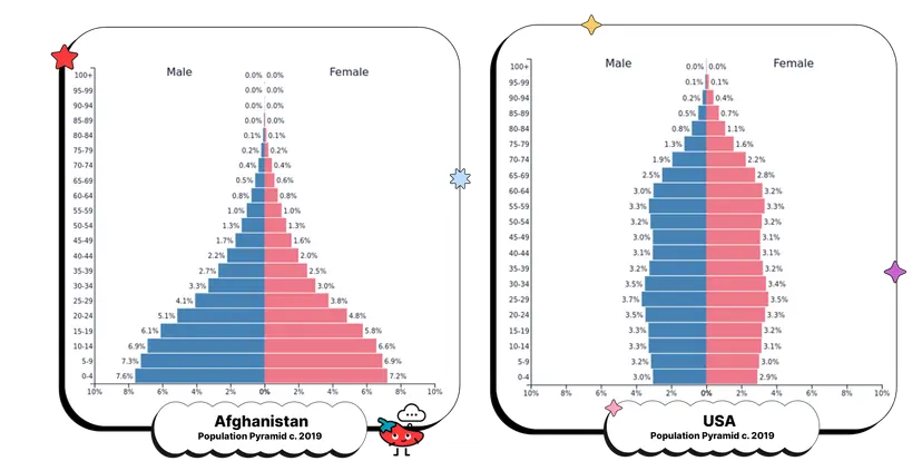
Wide bases indicate high birth rates and potential for rapid growth.
Narrow tops suggest higher mortality rates or an aging population.
Inverted pyramids often signal population decline due to low birth rates.
These pyramids provide insight into a country’s developmental stage and are often used in policy-making and planning.

Interconnection Between Population and Migration
Population and migration are deeply interrelated. High population growth in one region may lead to emigration due to overcrowding or lack of resources. Conversely, low population growth or aging populations in another region may lead to immigration to fill labor gaps and maintain economic productivity.
Migration affects:
Population density and urban-rural balance
Demographic composition (age, gender, ethnicity)
Economic structures (supply and demand for labor)
Cultural landscapes, introducing new languages, religions, and traditions
FAQ
Megacities commonly develop in coastal areas or near major rivers because these locations historically offered the best opportunities for trade, transportation, and resource access. Coastal and riverine locations allow for easier import and export of goods, supporting economic growth. These regions also often have fertile land and abundant freshwater, supporting agriculture and early human settlement.
Access to global shipping routes fosters economic activity and international trade.
Rivers and coastlines provide water for agriculture, industry, and human consumption.
Flat, low-lying areas near water are easier to build on and expand.
Historical patterns of colonization and industrialization often began along waterways.
As these cities grew, they attracted migration for employment and opportunity, further fueling population growth and urbanization.
Higher population density increases the demand for efficient and accessible transportation systems. Dense urban areas require diverse, well-integrated public transit options to reduce traffic congestion and pollution. In contrast, low-density areas rely more on personal vehicles due to longer distances between destinations and limited transit coverage.
High-density cities invest in subways, buses, and bike lanes to accommodate commuters.
Public transportation becomes more cost-effective and sustainable in densely populated regions.
High density encourages walkability and mixed-use development, reducing car dependency.
Poor transportation infrastructure in dense areas leads to overcrowding and delays, hindering mobility.
Urban planners must consider population density when designing transit systems to ensure accessibility and efficiency.
In democratic systems, population distribution plays a critical role in shaping political representation through the drawing of electoral districts and allocation of seats in legislatures. Areas with higher populations are often given more representatives, while sparsely populated areas may have fewer.
Census data is used to adjust political boundaries and ensure equal representation.
Uneven distribution can lead to overrepresentation of rural areas or underrepresentation of urban centers.
Gerrymandering can manipulate district boundaries to favor political parties, affecting fair representation.
Urban areas with dense populations often have diverse needs that require different policies than rural areas.
Understanding population distribution helps maintain balanced and equitable political systems.
High population density puts pressure on housing availability, infrastructure, and services. As more people move into urban areas, the demand for space increases, leading to rising housing costs, overcrowding, and informal settlements like slums.
Limited land leads to vertical construction (e.g., high-rise apartments).
Infrastructure (water, electricity, sewage) can become overwhelmed if not upgraded.
High demand for housing can outpace supply, creating affordability crises.
Informal housing may lack access to sanitation, electricity, and legal protections.
Governments and city planners must balance growth with infrastructure development to provide safe, affordable, and sustainable urban living environments.
Arable land is essential for agriculture, so areas with large, fertile farming zones typically support larger populations. These regions can feed more people, making them attractive for settlement and development. Conversely, areas with limited arable land tend to have lower population densities or face food insecurity.
Fertile valleys like the Indus, Nile, and Mekong support dense populations due to productive agriculture.
Nations with limited arable land (e.g., Japan, Saudi Arabia) often rely on food imports or technological solutions like hydroponics.
High physiological density indicates greater pressure on available farmland.
Agricultural policies and technological advancement can influence how effectively arable land supports a growing population.
Practice Questions
Describe how physical and human factors influence the spatial distribution of population. Provide examples for each type of factor.
Population distribution is shaped by both physical and human factors. Physical factors include climate, elevation, access to freshwater, and soil fertility. For example, fertile river valleys like the Ganges in India attract dense populations due to agricultural potential. Human factors include job opportunities, political stability, infrastructure, and social networks. Urban centers such as New York City attract people for employment and services. People avoid harsh environments like deserts and conflict zones while gravitating toward safe, economically vibrant, and well-connected areas. Together, these factors explain why populations are unevenly spread across the globe and concentrate in certain favorable regions.
Compare arithmetic, physiological, and agricultural population density. Explain what each measure reveals about a country's land use and population pressure.
Arithmetic density measures the average number of people per unit of land and shows overall population distribution. Physiological density calculates population per unit of arable land, revealing pressure on food-producing land. Agricultural density looks at the number of farmers per arable unit and reflects farming efficiency. For example, Egypt has low arithmetic density but high physiological density, indicating limited usable farmland. The U.S. has low agricultural density due to advanced technology, while some developing countries have high agricultural density, signaling labor-intensive farming. These three densities provide a more complete picture of how population interacts with land and resources.
