
AP Syllabus focus: ‘Transoceanic voyaging connected Eastern and Western Hemispheres, transforming trade networks and producing significant social impacts around the world.’
Transoceanic travel after 1450 linked the Atlantic and Pacific into regular routes, shifting commerce from regional circuits to intercontinental exchange. These connections reordered wealth, labor systems, and cultural contact across multiple continents.
What “transoceanic” change meant
From separate regions to connected oceans
European-sponsored crossings created sustained sea lanes that joined previously separate commercial zones:
The Atlantic became a corridor linking Europe, Africa, and the Americas.
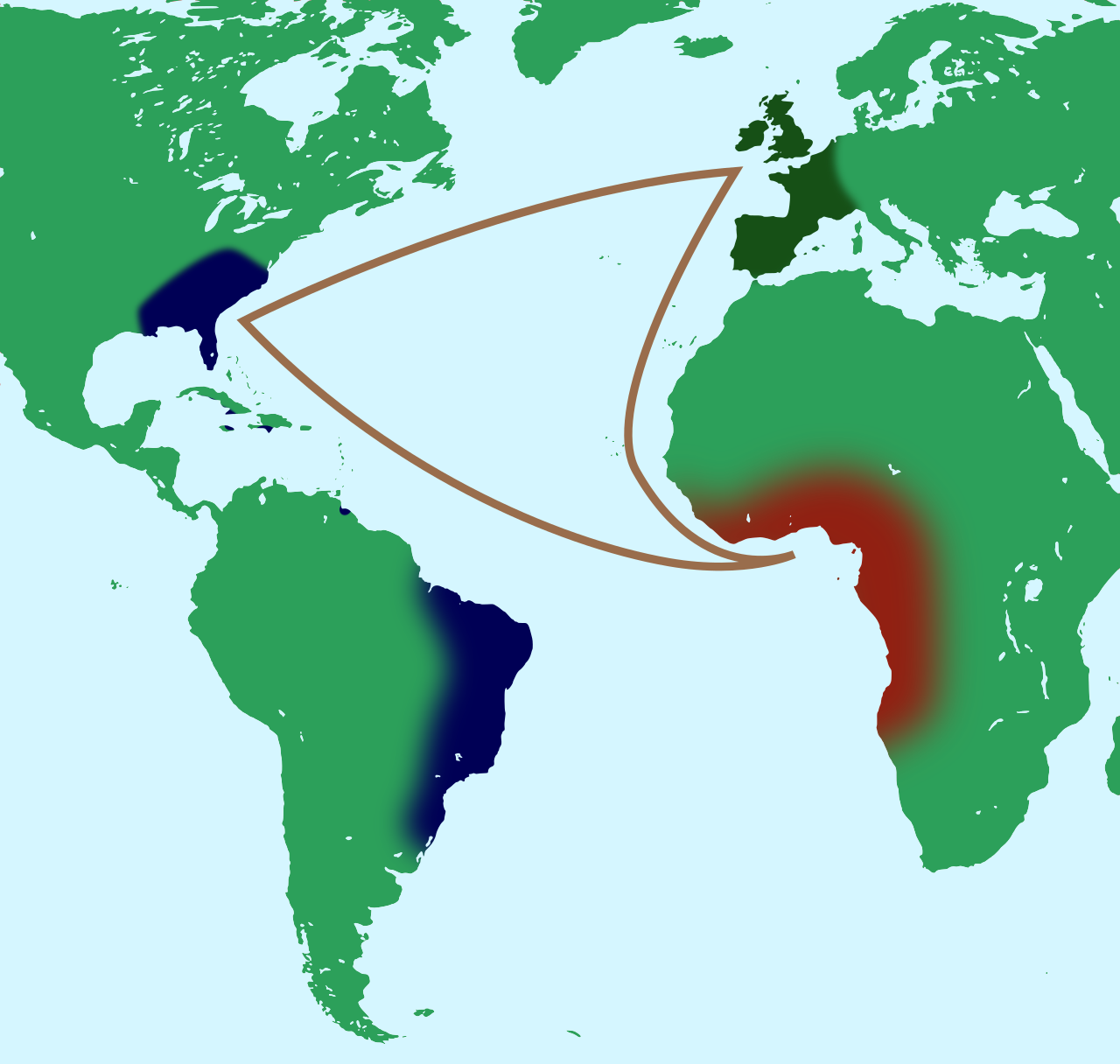
This diagram maps the transatlantic “triangular trade,” highlighting the recurring sea routes that linked Europe, West Africa, and the Americas. It visually summarizes how manufactured goods, enslaved labor, and plantation/export commodities moved through interconnected port systems. Use it to connect trade-network reorientation to the expansion of forced migration in Atlantic economies. Source
The Pacific connected the Americas to Asia through transpacific routes, tightening global circulation.
Unlock the rest of this chapter with a free account
Sign up for a free account to keep reading notes and practice questions.
FAQ
More consistent documentation (cargo lists, port records, correspondence) reduced uncertainty.
Faster circulation of news through merchant letters and printed reports helped traders react to distant price changes and shortages.
Advantages often included:
Deep-water harbours and safer anchorages
Access to inland transport routes
Stronger warehousing, repair facilities, and merchant networks
Political backing that concentrated legal trade in specific ports
They could disrupt shipping, raise transport costs, and prompt convoying.
Coastal settlements sometimes militarised, while some local economies benefited indirectly through black-market trade and ship provisioning.
High mortality from malnutrition and disease encouraged:
Staging stops at islands and coastal waypoints
Investment in provisioning systems
Preference for routes with reliable resupply, influencing which colonies grew fastest
Repeated voyages improved coastal charts and sailing directions.
Mapmakers increasingly compiled shared geographic information, standardising place names and routes, which helped normalise long-distance travel for later expeditions and merchants.
