
OCR Specification focus:
‘Use sampling techniques in fieldwork and use ICT such as data loggers, computer modelling or software to collect and process data.’
Fieldwork requires systematic sampling and modern digital tools to collect reliable ecological data, helping biologists identify patterns, measure environmental change and analyse species distribution efficiently.
Fieldwork Sampling Techniques
Fieldwork sampling involves collecting data from natural ecosystems to investigate the abundance, distribution and diversity of organisms. Biologists must use standardised sampling techniques to ensure data is valid, reliable and suitable for comparison.
Types of Sampling
Three core sampling approaches are used in OCR Biology fieldwork investigations:
Random sampling — avoids bias by giving every location an equal chance of selection.
Systematic sampling — taken at regular intervals across a habitat to measure changes along a gradient.
Stratified sampling — divides a habitat into sub-areas to ensure all important zones are represented.
Random sampling often uses random number tables or computer-generated coordinates, while systematic sampling commonly employs a belt or line transect.
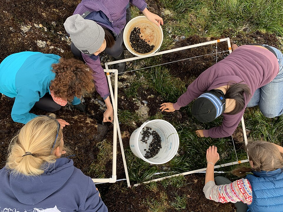
Researchers use quadrats along a transect to quantify abundance across an intertidal gradient, demonstrating systematic sampling for zonation studies. Source.
Systematic sampling is essential for studying zonation, such as across a rocky shore or changing light levels at a woodland edge.
Quadrat Sampling and Point Sampling
Quadrats provide a quantitative measure of abundance, allowing calculation of percentage cover or density. Point quadrats reduce observer bias by recording only organisms touching a vertical pin. In contrast, pitfall traps, sweep nets and pooters are used for mobile organisms, selected according to habitat and target species.
Abundance: The number of individuals of one species in a given area.
Sampling must be repeatable, with quadrat number, size and placement carefully controlled. Biologists also record abiotic factors, as physical conditions strongly influence species distribution.
Minimising Bias and Improving Reliability
Ecological data must be representative. To improve reliability:
Increase quadrat number and habitat coverage
Use randomisation wherever possible
Repeat sampling at different times or seasons
Standardise sampling effort, such as sweep duration or trap exposure time
Reliability is increased when multiple observers agree on species identification, which is known as inter-observer reliability.
Use of ICT in Fieldwork
ICT has transformed modern ecology. The specification requires the use of data loggers, modelling and software to collect, process and interpret biological data efficiently.
Data Loggers and Digital Sensors
Data loggers automatically record abiotic variables, including:
Temperature
Light intensity
Oxygen concentration
pH
Humidity
Data logger: An electronic device that automatically records data at set intervals using digital sensors.
Data loggers improve accuracy because they collect continuous data and eliminate human reaction time.
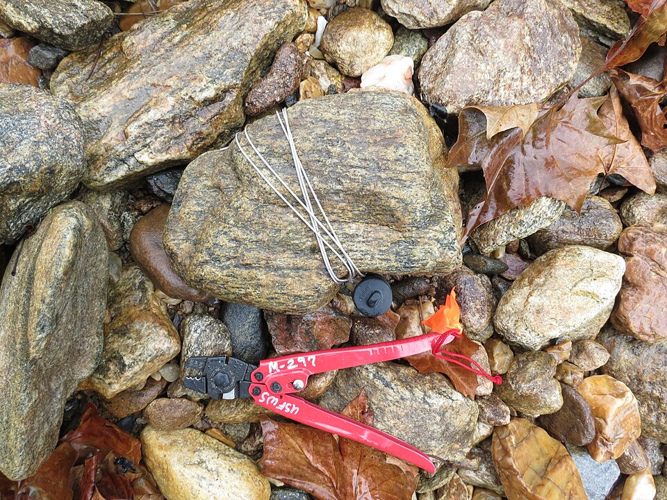
A temperature data logger installed in a stream to record abiotic conditions continuously, improving precision and reliability in environmental monitoring. Source.
They increase precision by reducing rounding errors and allow the identification of short-term fluctuations that would be missed by infrequent manual readings. After field collection, data are downloaded for analysis using graphing or statistical tools.
Software and Computer Modelling
ICT supports complex data processing through:
Spreadsheet software, for statistical tests such as Spearman’s rank or Simpson’s Index
Geographical Information Systems (GIS), which map species distribution
Ecological modelling software, used to predict changes in populations or habitats
Computer models allow scientists to simulate climate change effects or test conservation strategies without disturbing real ecosystems. Although models rely on assumptions, they are powerful predictive tools when supported by robust data sets.
Use of Identification Tools and Databases
Digital resources, including photographic databases and mobile identification apps, support accurate species identification, reducing human error. Misidentification is a major source of sampling inaccuracy, so ICT-based identification increases validity by standardising classification.
Between data collection and interpretation, ICT provides secure data storage, rapid graph production and clear visual presentation for scientific reports.
Transects and ICT-Assisted Sampling
Transects, whether line or belt, are standard methods for investigating gradual environmental change.
A line transect provides systematic sampling points along an environmental gradient, showing how distribution changes across a habitat. Source.
Systematic sampling points can be geolocated using GPS devices, ensuring that sites can be revisited precisely for long-term studies. ICT-generated transect graphs clearly show how abiotic gradients influence community structure.
Ethical and Practical Considerations
Fieldwork must avoid habitat damage and unnecessary disturbance. ICT reduces the need for intrusive sampling by enabling remote monitoring, and data loggers can operate continuously without removing organisms from their environment. Accurate sampling and digital recording are essential for conservation projects, woodland management and ecological impact surveys.
Linking Sampling to Statistical Interpretation
To extract meaning from ecological data, ICT tools allow rapid statistical analysis. Reliable sampling combined with digital data processing provides strong evidence to support ecological conclusions about distribution, abundance and biodiversity, in line with OCR expectations for rigorous scientific fieldwork.
Practice Questions
Question 1 (2 marks)
State two reasons why data loggers can improve the quality of abiotic data collected during fieldwork.
Question 1 (2 marks)
Award one mark for each valid point, up to two marks.
Continuous or frequent automated readings improve accuracy and identify short-term changes. (1)
Removes human error or reaction time, improving precision and reliability. (1)
Digital recording reduces risk of transcription or rounding errors. (1)
Question 2 (5 marks)
A student investigates how the abundance of a plant species changes along an environmental gradient from the centre of a field towards a shaded woodland edge. The student plans to use a transect and quadrats to collect data, and then use ICT to process the results.
Describe how the student should collect and process the data to ensure that the results are valid and reliable. In your answer, refer to fieldwork sampling and the use of ICT.
Question 2 (5 marks)
Award one mark for each valid point, up to five marks.
Use a systematic sampling method such as a line or belt transect across the gradient. (1)
Place quadrats at regular intervals along the transect to measure abundance. (1)
Standardise sampling, for example using the same quadrat size or sampling effort each time. (1)
Use ICT such as spreadsheets or data loggers to record, process or graph the results. (1)
Apply statistical or graphical analysis using software to identify trends or correlations. (1)
Use GPS or mapping software to ensure sampling points can be relocated for repeatability. (1) (max 5 marks)
FAQ
Random sampling is chosen when the habitat is fairly uniform and the aim is to avoid bias while estimating overall abundance or diversity. Each location has an equal chance of selection, which supports statistical validity.
Systematic sampling is preferred when there is an environmental gradient, such as changes in light, moisture or salinity. Sampling at regular intervals allows clearer detection of directional change across the habitat.
Geographical Information Systems (GIS) allow ecological data to be layered over maps, satellite images or terrain models. This makes it easier to visualise patterns in abundance or distribution.
GIS can also:
Display several abiotic and biotic variables together
Predict spatial trends
Support long-term monitoring with high accuracy
Calibration ensures that sensors are giving accurate readings before data collection begins. Temperature, pH or oxygen probes may drift over time, or respond differently under new environmental conditions.
Without calibration:
Systematic errors may be introduced
Comparisons with previous studies become unreliable
Data may need to be discarded
ICT tools such as digital keys, photo recognition software and online taxonomic databases provide standardised criteria for identification. This reduces reliance on memory or subjective judgement.
These tools also enable:
Verification of uncertain samples
Cross-checking between observers
Long-term consistency in repeat surveys
Linking quadrat data to abiotic measurements helps ecologists explain why species are distributed in particular patterns. Continuous data from loggers can reveal fluctuations that influence organism abundance, such as temperature or light changes.
This strengthens ecological conclusions by allowing correlations between physical conditions and biological responses.
